

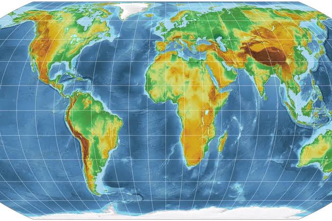
The United Nations General Assembly has backed wider use of the Equal Earth map projection, which represents continents closer to their true relative sizes.
The non-binding resolution passed with 164 votes in favor, one against, and six abstentions. It was led by Togo and supported by the African Union.
Many familiar classroom maps use the Mercator projection, which was designed for navigation. However, it dramatically enlarges areas near the poles. Greenland can consequently appear comparable to Africa even though Africa is about 14 times larger.
Equal Earth maintains a familiar world-map shape while reducing those distortions. Supporters argue that maps influence how people understand geography, global importance, and power.
The resolution does not prevent ships and other navigators from using Mercator-based tools where they remain useful. Instead, it encourages schools, international organizations, and publishers to choose more accurate projections for general education and communication.
For Africa, the decision is both geographical and symbolic: the continent should no longer be visually reduced by default.
No comments yet. Be the first to share your thoughts.